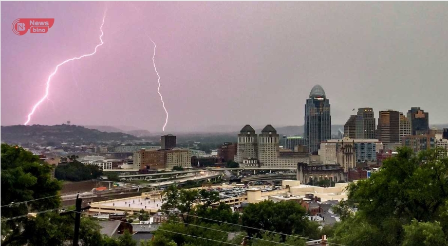
Chaos in the Sky: Cincinnati’s Night of Tornado Terror
Greater Cincinnati & Northern Kentucky
Sunday night was a relentless battle between nature’s fury and the resilience of Greater Cincinnati and Northern Kentucky residents. What started as routine showers quickly escalated into a night of chaos, power outages, and tornado sirens piercing through the air.
By 11:05 p.m., the National Weather Service had begun canceling tornado watches across the region, but the damage had already been done. Heavy winds, torrential rains, and multiple tornado warnings had left an estimated 8,000 households in darkness, according to Duke Energy. The city’s skyline, usually buzzing with life, was reduced to a ghostly silhouette against the raging storm.
Earlier in the evening, the region braced for impact as forecasters warned of “strong to severe” thunderstorms rolling in with a cold front. The primary threats? Devastating winds, baseball-sized hail, and the terrifying possibility of tornado touchdowns. And Mother Nature delivered.
At 9:45 p.m., Greater Cincinnati and Northern Kentucky were drenched in heavy rain, with scattered power outages affecting thousands. Tornado warnings had passed in most areas, but a tornado watch remained in effect until 1 a.m. Monday. Emergency responders scrambled to clear downed trees and power lines as scanner traffic reported damage across Hamilton and Butler counties.
As the storm moved eastward, the worst was yet to come for Warren County. At 9:18 p.m., another tornado warning was issued for northeastern parts of the county, including Wilmington, Sabina, and Waynesville. Radar confirmed a severe thunderstorm near Waynesville, moving east at 55 mph. Reports of quarter-sized hail only added to the growing fear gripping the community.
Minutes later, at 9:04 p.m., the National Weather Service issued a chilling statement: “Residents in this area need to take cover now.” Mason, Lebanon, and South Lebanon were in the crosshairs of another possible tornado, with radar indicating intensifying circulations in the storm system. The warning for Hamilton County and Northern Kentucky had expired, but the night was far from over.
By 8:41 p.m., the third tornado warning of the night was declared for Butler and Warren counties, sending residents scrambling for shelter. Cities like Middletown, Hamilton, and Lebanon found themselves in the direct path of yet another destructive storm. Radar tracked a severe thunderstorm over Seven Mile, racing east at 45 mph, threatening to unleash its full fury.
The chaos continued with back-to-back warnings across Indiana, Northern Kentucky, and Southwest Ohio. Officials urged residents to take shelter immediately, moving to basements or interior rooms. The ominous sound of sirens filled the air as the National Weather Service cautioned that flying debris, roof damage, and fallen trees were all but inevitable.
As the final storm cells moved out of the region, the damage assessment had only begun. Fallen power lines, uprooted trees, and shattered windows painted a grim picture of Cincinnati’s storm-ravaged night. Duke Energy crews worked tirelessly to restore power to thousands left in the dark, while meteorologists warned that more storms could be on the way by midweek.
For Cincinnatians, Sunday night’s storm wasn’t just another severe weather event—it was a reminder of nature’s unpredictable wrath. The echoes of sirens, flashes of lightning, and roaring winds will linger in the memories of those who lived through it, adding yet another chapter to the city’s history of battling the elements.
Author
-
Ngbede Silas Apa, a graduate in Animal Science, is a Computer Software and Hardware Engineer, writer, public speaker, and marriage counselor contributing to Newsbino.com. With his diverse expertise, he shares valuable insights on technology, relationships, and personal development, empowering readers through his knowledge and experience.
View all posts


Be the first to comment