Arizona’s Weather Rollercoaster: Double Storm Threat Brings Rain, Snow, and Chaos!
Brace yourselves, Arizona! Mother Nature is shaking things up with a double dose of powerful storm systems sweeping across the state. From wind-whipped deserts to snow-covered peaks, this is the kind of weather shake-up we haven’t seen in a while. If you thought Arizona’s mild winter was sticking around, think again!
Storm #1: A Wild Start to the Week
The first storm is already making its presence known today, kicking off big weather changes that will have you reaching for both your raincoat and your windbreaker. Here’s what to expect:
- Valley Rain: A 30% chance of rain mainly in the morning, with clouds hanging around before giving way to afternoon sunshine. Highs will reach a comfortable 70°F—but don’t let that fool you.
- Wicked Winds: Winds statewide are whipping up dust and debris, with gusts hitting 30-35 mph in the Valley and a Wind Advisory in effect for areas north and east of the Mogollon Rim up to Four Corners.
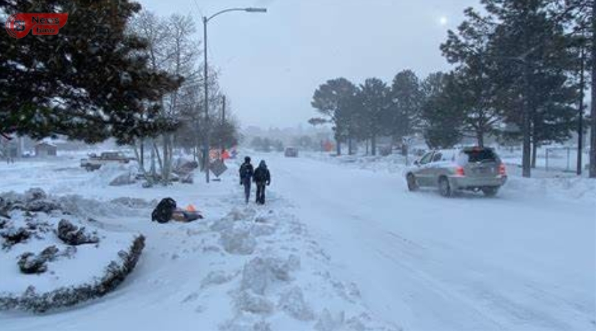
- Flagstaff’s First Flakes: Snow lovers, get ready! 4 to 8 inches of snow are expected in Flagstaff, where a Winter Weather Advisory is in effect until 6 p.m. Schools in the Flagstaff Unified School District are CLOSED today in anticipation of the snowy mess.
- Bigger Trouble Ahead: And just when you thought you could relax, a Winter Storm Warning kicks in at 11 p.m. and lasts through Friday at 5 p.m. for elevations above 5,000 feet in Northern Arizona. More snow is coming!
Storm #2: The Big One Hits Friday
If today’s storm is the opening act, Friday’s storm is the grand finale—and it’s going to be a First Alert Weather Day. That means more rain, colder temps, and a major snow event for Northern Arizona.
- Valley Soaker: Rain chances jump to a 70% likelihood, with up to half an inch of rainfall drenching the Phoenix metro area. Expect widespread morning showers and lingering rain into the afternoon. Highs will struggle to reach 58°F, making it one of the coldest days in recent weeks.
- Blizzard Conditions in Higher Elevations: Northern Arizona is in for a snowstorm showdown. Flagstaff is bracing for another 8-12 inches, with spots like Heber and Show Low expecting 6-8 inches. Even lower elevations like Prescott, Payson, and Sedona could see measurable snowfall.
- Snow Levels Dropping: With snow levels falling to 4,000 feet, expect a winter wonderland in Southern Gila County as well. If you’re traveling up north—be prepared for hazardous roads and possible closures.
Looking Ahead: What’s Next for Arizona?
After a chaotic end to the week, the weekend will offer a brief reprieve—dry skies, rising temperatures, and a much-needed break from the storm parade. But don’t get too comfortable! More storms could return next week, with at least two more rounds of wild weather on the horizon.
So buckle up, Arizona! This weather rollercoaster is just getting started. Stay tuned for updates, keep those jackets handy, and get ready for a rare taste of winter in the desert.
Are You Ready for the Storm?
- Tag a friend who needs to know about these storms!
- Drop a comment: Are you excited for the rain & snow or dreading the chaos?
- Stay safe and stay tuned for the latest updates as this weather saga unfolds!
Author
-
View all posts
Ngbede Silas Apa, a graduate in Animal Science, is a Computer Software and Hardware Engineer, writer, public speaker, and marriage counselor contributing to Newsbino.com. With his diverse expertise, he shares valuable insights on technology, relationships, and personal development, empowering readers through his knowledge and experience.


Be the first to comment